When the United States and Canada sat down in the 1800s to draw the lines between their respective territories in the Pacific Northwest, they did what any sensible government does: they looked at the land, noted the prominent features, and wrote them into the treaty. Mountains. Rivers. Ridgelines. And in some stretches of the border, glaciers — enormous, ancient, seemingly permanent rivers of ice that had been sitting in the same general location for thousands of years.
The word "seemingly" is doing a lot of work in that sentence.
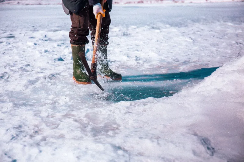
Glaciers, it turns out, move. Not quickly. Not in any way you'd notice over a weekend. But over decades, a glacier can shift its mass significantly — advancing, retreating, or sliding laterally in ways that have nothing to do with the lines humans drew across the landscape and everything to do with gravity, temperature, and the slow physics of compressed ice. And when a glacier that was used as a boundary marker decides to relocate, the legal question of where exactly the border sits becomes genuinely, unexpectedly complicated.
The Line That Nature Didn't Consult
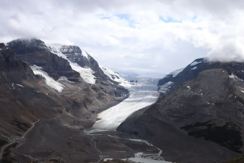
The US-Canada border through the Pacific Northwest and Alaska is one of the longest international boundaries on Earth, and significant stretches of it run through terrain that is, to put it mildly, not designed for easy surveying. Mountain ranges, river systems, and glaciated valleys all form part of the boundary, and the 19th-century treaties that established it were written by people who had a reasonable but imperfect understanding of how dynamic that landscape actually was.
The specific glacier at the center of this story sits in a region where the boundary cuts through heavily glaciated terrain — the kind of place where the ice is thick, the winters are long, and the nearest permanent human settlement is a significant distance away. For most of the 20th century, the exact position of the ice relative to the official border line wasn't something anyone checked with great regularity. The general location was known. The precise coordinates were another matter.
When a joint US-Canadian survey team revisited the area as part of a broader boundary maintenance effort, they brought with them GPS technology and updated geodetic data that their 19th-century predecessors obviously lacked. What they found, after careful measurement, was that the glacier had moved. Not a little. Enough that a meaningful section of glacial mass — along with the rock and terrain features beneath it — now sat on the Canadian side of the boundary line according to the original treaty coordinates.
America had been treating it as American territory. By the strict reading of the treaty, it wasn't.
What the Treaty Said — and Didn't Say
Here is where the story becomes a genuinely fascinating puzzle in international law.
The treaties governing this stretch of the border — primarily the Anglo-Russian Treaty of 1825, which established the original boundary before Alaska became American territory, and subsequent agreements that refined and confirmed it — described the boundary in terms of physical features. Where the line crossed glaciated areas, the ice itself was sometimes referenced as a landmark.
But those treaties were written with the assumption that the described features were fixed. Rivers shift course, which is why many international boundaries specify the thalweg — the deepest channel — rather than a static line. But glaciers? Nobody in the 1820s was writing contingency language for glacial drift. The ice was simply there, enormous and apparently eternal, and that was that.
When American and Canadian officials began reviewing the survey findings, they confronted a question the treaty had no answer for: when a boundary marker moves under its own geological power, does the boundary move with it, or does the boundary stay where the original coordinates said it was, now sitting in the middle of a different piece of ice?
Legal scholars who have looked at similar cases note that international boundary law generally favors fixed coordinates over mobile landmarks — but that principle isn't universal, and the specific treaty language mattered enormously. In this case, the language was ambiguous enough that both governments had a defensible position.
The Quietly Diplomatic Scramble
What happened next is a testament to the fact that the US and Canada are, whatever their occasional disagreements, genuinely good at not turning bureaucratic problems into international incidents.
The International Boundary Commission — a joint body established in 1908 that maintains and monitors the US-Canada border — became the primary venue for working through the issue. The IBC operates largely outside of public view, which is part of why this story never became a headline-grabbing diplomatic crisis. It was handled the way most US-Canada border questions are handled: quietly, technically, and with a remarkable amount of mutual goodwill.
Negotiations involved surveyors, lawyers, and diplomats from both sides reviewing the original treaty language, the survey data, and the practical reality of the terrain. The question of who "owned" the affected area was less urgent than it might sound — the land in question was not commercially developed, not home to any permanent population, and not strategically significant in any obvious military sense. What mattered was getting the official record straight.
The resolution, reached without fanfare and announced in the kind of bureaucratic language designed to be understood only by people who already know what they're looking at, essentially established a process for updating the boundary reference points to reflect current glacial positions while preserving the integrity of the original treaty framework. In plain terms: the two governments agreed on a way to acknowledge that the ice had moved and adjust the official record accordingly, without either side having to formally concede that it had been wrong about where its territory ended.
Nature's Indifference to Human Paperwork
There is something deeply, almost philosophically funny about a glacier ignoring an international treaty. The ice didn't know it was crossing a border. It didn't have opinions about sovereignty. It was simply doing what glaciers do — responding to temperature gradients and gravitational pull and the slow accumulation of snowfall over centuries — and the fact that two nations had agreed, at some point in the 1800s, that it marked the edge of their respective territories was not information it had access to or interest in.
The episode is a small but vivid illustration of something that geographers and boundary specialists have long understood: the lines on a map are human inventions, and the physical world has no particular obligation to respect them. Rivers migrate. Coastlines erode. Islands appear and disappear. And glaciers, as it turns out, wander.
The US and Canada resolved this one without drama, which is the right outcome. But somewhere in the Pacific Northwest, the ice is still moving — on its own schedule, following its own logic, completely indifferent to the paperwork.